Scheda punto di interesse


DESCRIPTION
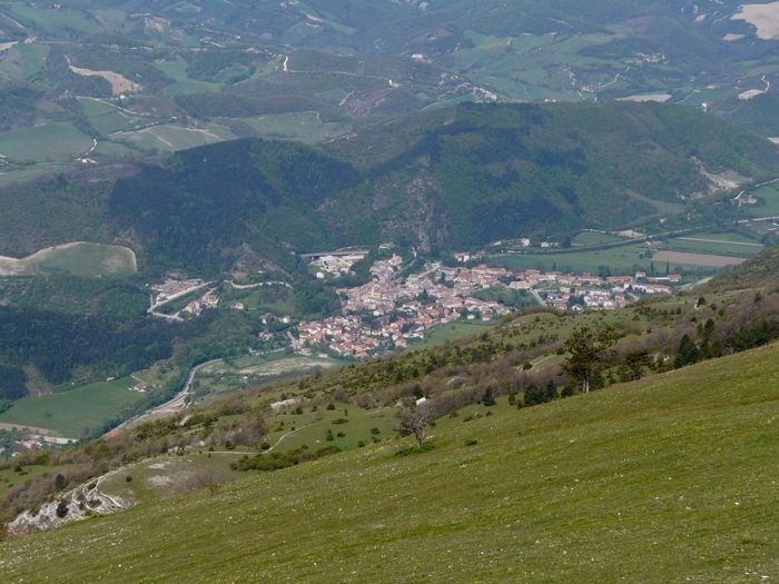
The city of Cantiano is the heir of Luceolis, attested by literary sources at least since the end of the sixth century a.D. The exact location of Luceolis is very debated and the possibilities are three, respectively, in connection with the modern towns of Scheggia, Pontericcioli, or Cantiano.
Probably, the most accredited hypothesis, leaning on a meaningful indication provided by Tabula Peutingeriana, is the oppidum of Luceolis, the medieval center of Cantiano. It is identified between the stations of Ad Ensem and Ad Calem, fourteen miles distant from each other, an intermediate statio seven miles far from Ad Ensem.
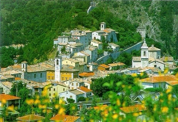
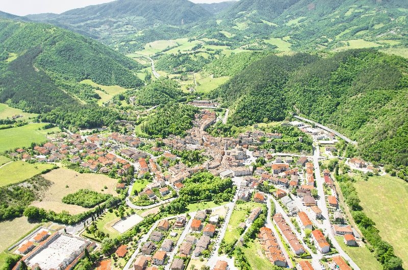
The actual village called Cantiano is located exactly in the middle between Scheggia and Cagli, is crossed in its center by the heir of the Flaminia (through the “Ghetto”) and it has the characteristics of a double unconquerable fortress; here are, in fact, present two adjacent hills, whose intermediate gorge was crossed by the ancient road. The remains of the two fortresses on the roadside are still recognizable, linked by defensive walls, which in medieval times barred the passage, the same function of the one of the Oppidum of Luceolis.
The ancien tradition supposes that Cantiano (whose name derived from the River) rose on the ruins of Luceolis.
Near Cantiano, to the north, it was also found a milestone indicating the distance in miles from Rome (CXL The inscription mentions the Caesars Valerio Severo and Massimino Daia and it dates back a period included between the 1st of may 305 and the 25th of july 306.
To the north of Cantiano, the Flaminia is wedged for several miles into the narrow Burano gorge; the modern national road follows almost the entire route of the consular road, conditioned by the harshness of the natural gap in the steep mountains. Outside Cantiano, to the east, a long retaining wall from the Roman period came to light, similar to the above reported at Three Arches Bridge, partly concealed during recent road works; several other powerful substructures, preserved for hundreds of meters in length, have been found during the construction of the modern highway. The construction technique used was similar to that of the substructures at the Three Arches Bridge and Furlo Gorge, in the context of a unitary intervention probably from the Augustan era.


Around


The Marche Region promotes the project of cultural evolved district (DCE) in Marche as a strategic action of regional planning coherently promoted with the European directives. Addresses, procedures and parameters to classify regional projects of DCE are identified in DGR 1753/2012.

 Page loaded in: 0.066 - Powered by Simplit CMS